 All-in-one survey, CAD and Irrigation Design Software
Design various pressurized irrigation systems ranging from large-scale agricultural designs to small-scale landscape designs.
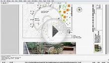
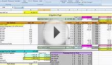
Calculate hydraulics, pressures, flows and quantities. Set out coordinates, drawing plans and 3D images. Then let Irri-Maker program will evaluate design alternatives, produce a bill of materials and send drawing results back to AutoCAD and Google Maps.
Comprehensive Designs
Irri-Maker handles the various design processes with ease by creating a seamless flow of data between survey topography, computer aided design functions, irrigation design elements, as well as input and output to Google Maps.
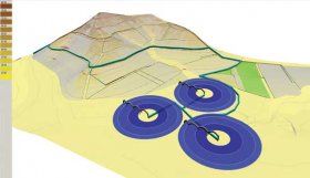 It enhances Google Maps’ information on terrain images and elevations and lets you use this information to build contour plans or use your own survey data to draw detail plans and apply the irrigation design.
Flexible Irrigtion Design
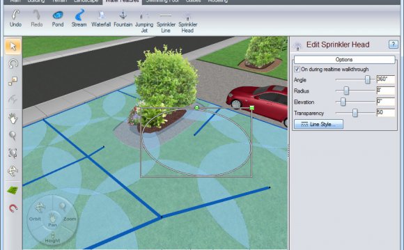
Irri-Maker allows each element of the design to be controlled. This includes defining block areas, adding emitters and pipes, sizing the pipes, and calculating the hydraulic layouts for agricultural farms, landscape areas, mining or other areas where water conveyance is required.
Pivots can be positioned and the topography underneath analyzed. Irri-Maker also provides a comprehensive list of materials as well as reports on pressures, velocities and quantities.
Google and AutoCAD Advantages
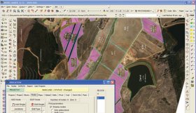
Irri-Maker lets you produces contour plan from virtually any type of survey data including Google Earth. It optimizes irrigation system design by combining survey, Digital Terrain Modeling (DTM) and Computer Aided Design (CAD), with many hydraulic analysis functions.
The built-in CAD module allows you to add specific details like roads, fences, boundaries, rivers, and trees to the contour plan, including text and bitmap images. Irri-Maker has various modules working together with the same set of commands. There is no need to learn different programs or menu layouts to add CAD elements and irrigation designs to your contour plan. Everything can be plotted independently or in combination.
YOU MIGHT ALSO LIKE

Share this Post
latest post
-
 Landscape Design articles February 3, 2017
 -
 House Garden Landscape Design January 26, 2016
 -
 Waterfall Landscape Design January 4, 2017
 -
 Modern Landscaping Design December 24, 2015
 -
 Landscaping Garden Design June 13, 2016
 -
 Hospital Landscape Design July 11, 2018
 -
 Landscape Design Program for Mac April 7, 2017
 -
 Landscape Design New York December 4, 2017
 -
 Adelaide Landscape Designers March 5, 2017